
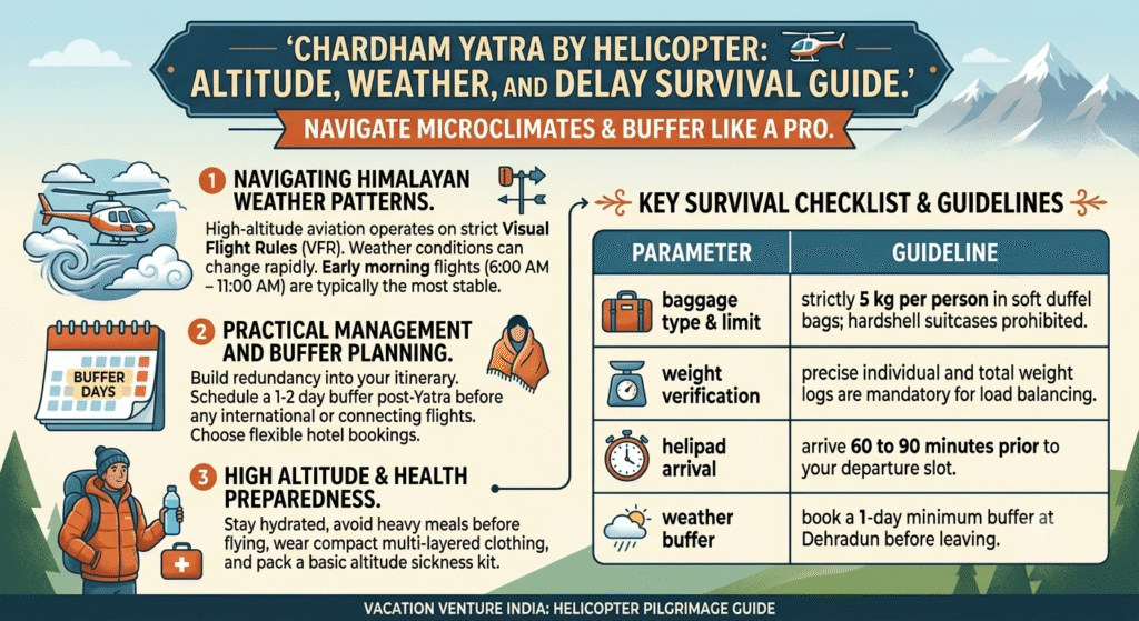
Flying through the Garhwal Himalayas for the sacred Chardham Yatra is an unparalleled privilege, but high-altitude aviation in mountain microclimates requires strategic planning. Rapid weather shifts, mountain cloud cover, and sudden wind turbulence at 11,000+ feet frequently impact flight schedules across Phata, Sersi, Guptkashi, and Dehradun.
Whether you are navigating shuttle flights or private multi-day charter itineraries, here is how to prepare for mountain weather realities, avoid altitude sickness, and build an airtight schedule.
1. Navigating Himalayan Weather Patterns
High-altitude aviation operates under strict Visual Flight Rules (VFR). The Directorate General of Civil Aviation (DGCA) and local air safety marshals mandate zero-tolerance visibility limits.
- Morning Clarity (6:00 AM – 11:00 AM): The most stable flying window across all four shrines. Thermal currents and cloud cover are generally minimal during early mornings.
- Afternoon Cloud Cover (12:00 PM – 3:30 PM): Moist air rising from valleys often creates thick cloud layers around Kedarnath (3,583 m) and Yamunotri valley corridors, leading to temporary flight holds.
- Monsoon & Seasonal Shifts: Late May to early July brings unpredictable micro-storms, while September and October offer clearer skies but lower early-morning temperatures.

2. Essential Itinerary Safeguards: The “1-Day Rule”
Weather holds are a normal part of mountain aviation. Protecting your return travel starts with building flexibility into your travel itinerary:
- Buffer Day at Dehradun or Haridwar: Never book onward train or flight connections on the same day your helicopter Yatra concludes. Always schedule a 24-hour buffer day post-Yatra.
- Flexible Accommodation Bookings: Work with tour facilitators who provide adaptable hotel arrangements in case bad weather grounds flights overnight at Guptkashi, Sersi, or Badrinath.
- Clear Refund Protocols: Authorized government shuttle tickets via IRCTC Heliyatra or certified charter operators provide 100% fare refunds if sorties are canceled due to severe weather.
3. High Altitude & Health Preparedness
Ascending rapidly from Dehradun (1,470 ft) or Guptkashi (4,320 ft) to Kedarnath (11,750 ft) within a 10-minute helicopter flight bypasses gradual natural acclimatization.
- Hydration over Heavy Meals: Drink plenty of water and warm fluids prior to boarding. Avoid heavy meals immediately before flying to minimize altitude-induced nausea.
- Layering Strategy: Temperatures drop drastically above 10,000 feet. Carry compact thermal down jackets, windbreakers, thermal socks, and inner thermals in hand carry.
- Medical Screening: Ensure senior pilgrims undergo pre-Yatra blood pressure and oxygen saturation checks. Portable pulse oximeters and personal medical kits are strongly advised.
Key Survival Checklist for Flying
| Parameter | Guideline |
| Baggage Type & Limit | Strictly 5 kg per person in soft duffel bags (no hardshell suitcases). |
| Weight Verification | Individual weights are logged prior to boarding; accuracy is critical for load balancing. |
| Helipad Arrival | Arrive at least 60 to 90 minutes prior to your assigned departure slot. |
| Mandatory Documents | Printed Yatra Registration Pass + Original Photo ID (Aadhaar / Passport). |